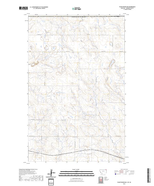
2024 Map of Plentywood NW
USGS Topo · Published 2024About this map
The Sheridan County Waterfowl Production Area occupies a central position in this corner of Sheridan County, highlighting the region's commitment to conservation within its expansive prairie landscape. The terrain is defined by a network of drainage ways and seasonal watercourses, including the winding Plentywood Creek and Harrys Creek. These water features are essential markers in an area characterized by low relief and high agricultural and ecological value, where the grid of public land surveys meets the natural contours of the Montana plains.
Find a feature on this map
18 named features on this map. Tap any name to fly to it.
Don’t see what you’re looking for? This feature index may not catch every label — zoom into the map to look around manually.
Map Details
Editions of this 2024 Plentywood NW Map
This is the sole edition of this map. No revisions or reprints were ever made.
Other maps of this area

1954 · Wolf Point
USGS Topo · 1:250,000

1958 · Wolf Point
USGS Topo · 1:250,000

1983 · Plentywood NW
USGS Topo · 1:24,000

1983 · Outlook
USGS Topo · 1:24,000

1983 · Archer
USGS Topo · 1:24,000

1983 · Plentywood
USGS Topo · 1:24,000

1983 · Raymond
USGS Topo · 1:24,000
1983 · Plentywood SW
USGS Topo · 1:24,000
2011 · Plentywood SW
USGS Topo · 1:24,000
2011 · Plentywood
USGS Topo · 1:24,000