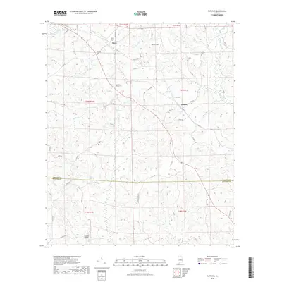
2018 Map of Pletcher
USGS Topo · Published 2018About this map
The boundary between Chilton and Autauga counties defines this Central Alabama landscape, where the settlements of Adams and Pletcher serve as local anchors. Numerous family and community burial grounds are scattered across the terrain, including Mount Carmel Cem, Antioch Cem, and Vermont Cem, providing significant points of interest for genealogical research in these rural townships.
Find a feature on this map
71 named features on this map. Tap any name to fly to it.
Don’t see what you’re looking for? This feature index may not catch every label — zoom into the map to look around manually.
Map Details
Editions of this 2018 Pletcher Map
This is the sole edition of this map. No revisions or reprints were ever made.
Other maps of this area

1891 · Clanton
USGS Topo · 1:125,000

1953 · Montgomery
USGS Topo · 1:250,000

1956 · Montgomery
USGS Topo · 1:250,000

1957 · Montgomery
USGS Topo · 1:250,000

1959 · Plantersville
USGS Topo · 1:62,500

1959 · Billingsley
USGS Topo · 1:62,500
1971 · Maplesville East
USGS Topo · 1:24,000

1971 · Maplesville West
USGS Topo · 1:24,000
1972 · Clanton West
USGS Topo · 1:24,000

1975 · Plantersville SE
USGS Topo · 1:24,000