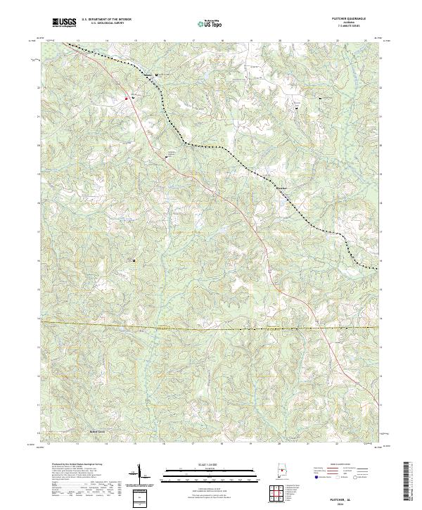
2024 Map of Pletcher
USGS Topo · Published 2024About this map
Adams and Pletcher anchor a landscape defined by the shifting terrain between Mulberry Creek and its various tributaries near the Chilton and Autauga county line. The map highlights a series of community burial grounds that serve as vital markers for local family history, including Mount Carmel Cem and Antioch Cem. The drainage patterns of Beaver Branch and Buck Creek illustrate the dissected topography of the region, while the southern reaches of the survey extend toward Bethel Grove. This contemporary record documents the established road networks, such as Co Rd 334, which connect these rural communities across the rolling pine and hardwood hills of central Alabama. The presence of Lake Pearl and numerous small branches reflects the hydrological character of the upper Gulf Coastal Plain.
Find a feature on this map
72 named features on this map. Tap any name to fly to it.
Don’t see what you’re looking for? This feature index may not catch every label — zoom into the map to look around manually.
Map Details
Editions of this 2024 Pletcher Map
This is the sole edition of this map. No revisions or reprints were ever made.
Other maps of this area

1891 · Clanton
USGS Topo · 1:125,000

1953 · Montgomery
USGS Topo · 1:250,000

1956 · Montgomery
USGS Topo · 1:250,000

1957 · Montgomery
USGS Topo · 1:250,000

1959 · Plantersville
USGS Topo · 1:62,500

1959 · Billingsley
USGS Topo · 1:62,500
1971 · Maplesville East
USGS Topo · 1:24,000

1971 · Maplesville West
USGS Topo · 1:24,000
1972 · Clanton West
USGS Topo · 1:24,000

1975 · Plantersville SE
USGS Topo · 1:24,000