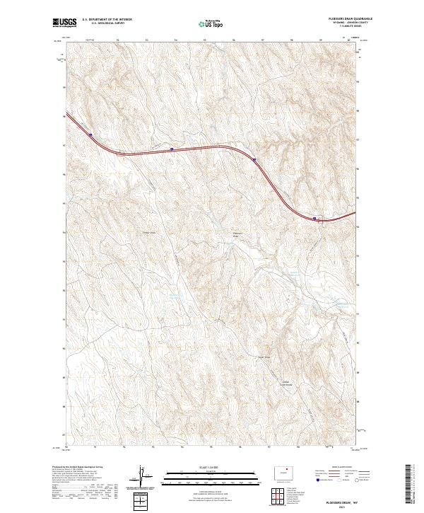
2021 Map of Ploessers Draw
USGS Topo · Published 2021About this map
Ploessers Draw and the surrounding drainage basins of Johnson County are defined by a network of seasonal watercourses and remote ranching access roads. This high-plains landscape in northern Wyoming is characterized by its distinct topographic features, such as the Indian Creek Divide and various draws that feed into ephemeral streams like Flying E Cr and Indian Cr. Water management is central to the area's geography, evidenced by the presence of the Indian Cr Reservoir and Alexander Reservoir, which likely serve as vital resources for livestock in this arid environment. The map shows a transition from the lower elevations of Ploessers Dry Lake to the higher ridges, punctuated by labels for Timber Draw and Coyer Draw. This survey serves as a record of the rural infrastructure of the early 21st century, where primary transit relies on unpaved routes like Dry Creek Rd and Schoonover Rd.
Find a feature on this map
19 named features on this map. Tap any name to fly to it.
Don’t see what you’re looking for? This feature index may not catch every label — zoom into the map to look around manually.
Map Details
Editions of this 2021 Ploessers Draw Map
This is the sole edition of this map. No revisions or reprints were ever made.
Other maps of this area

1955 · Sheridan
USGS Topo · 1:250,000

1958 · Sheridan
USGS Topo · 1:250,000

1962 · Sheridan
USGS Topo · 1:250,000
1972 · Crazy Woman Ranch
USGS Topo · 1:24,000
1972 · Ploessers Draw
USGS Topo · 1:24,000
1972 · Pine Gulch
USGS Topo · 1:24,000
1972 · Bear Draw
USGS Topo · 1:24,000
1972 · Somerville Flats West
USGS Topo · 1:24,000
1972 · Brown Ranch
USGS Topo · 1:24,000
1972 · Bowman Flat
USGS Topo · 1:24,000