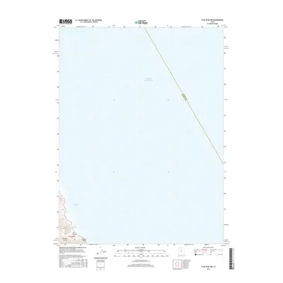
2017 Map of Plug Peak NW
USGS Topo · Published 2017About this map
Stansbury Island anchors the southwestern corner of this survey, where the rugged land meets the expanse of the Great Salt Lake. The terrain is defined by the high ridges above Pass Canyon, reaching toward the shoreline at Morgan Point. This specific environment highlights the importance of reliable water sources in an otherwise arid and saline landscape, marked here by Pass Canyon Spring and Four Pools Spring. The map clearly delineates the administrative boundary between Davis Co and Tooele Co, which cuts diagonally across the open waters of the lake. The coastal geometry of Stansbury Bight reveals the interface between the island's mountainous topography and the shifting margins of the salt lake, providing a clear record of the local geography in the late 2010s.
Find a feature on this map
9 named features on this map. Tap any name to fly to it.
Don’t see what you’re looking for? This feature index may not catch every label — zoom into the map to look around manually.
Map Details
Editions of this 2017 Plug Peak NW Map
This is the sole edition of this map. No revisions or reprints were ever made.
Other maps of this area

1885 · Tooele Valley
USGS Topo · 1:250,000

1953 · Tooele
USGS Topo · 1:250,000

1954 · Brigham City
USGS Topo · 1:250,000

1955 · Tooele
USGS Topo · 1:250,000

1958 · Brigham City
USGS Topo · 1:250,000

1962 · Brigham City
USGS Topo · 1:250,000

1968 · Plug Peak SE
USGS Topo · 1:24,000

1968 · Plug Peak NW
USGS Topo · 1:24,000

1968 · Fremont Island SW
USGS Topo · 1:24,000

1968 · Badger Island
USGS Topo · 1:24,000