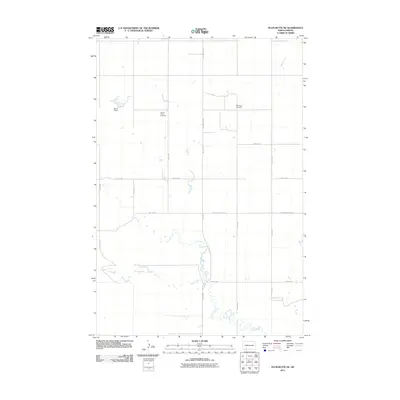
2011 Map of Plum Butte NE
USGS Topo · Published 2011About this map
Pilgerheim Cemetery and Sacred Heart Cemetery anchor this rural North Dakota landscape, providing significant points of interest for genealogists tracing family histories in Hettinger County. The terrain is defined by the winding paths of Timber Creek and Sheep Creek, which meander through a grid of section-line roads and larger thoroughfares like County Hwy 2141. The presence of Brown Dam suggests the importance of water management in this agricultural region, where local landmarks are often tied to the land's hydrology or community burial grounds. This survey preserves the early 21st-century configuration of local infrastructure, including uniquely named routes like Black and Blue Rd and various numbered avenues and streets that crisscross the prairie.
Find a feature on this map
17 named features on this map. Tap any name to fly to it.
Don’t see what you’re looking for? This feature index may not catch every label — zoom into the map to look around manually.
Map Details
Editions of this 2011 Plum Butte NE Map
This is the sole edition of this map. No revisions or reprints were ever made.
Other maps of this area

1953 · Dickinson
USGS Topo · 1:250,000

1954 · Bismarck
USGS Topo · 1:250,000

1957 · Dickinson
USGS Topo · 1:250,000

1958 · Bismarck
USGS Topo · 1:250,000

1969 · Burt
USGS Topo · 1:24,000

1969 · Bentley
USGS Topo · 1:24,000

1972 · Coffin Buttes
USGS Topo · 1:24,000

1972 · New Leipzig South
USGS Topo · 1:24,000

1972 · Round Top
USGS Topo · 1:24,000
1974 · Nason Hill
USGS Topo · 1:24,000