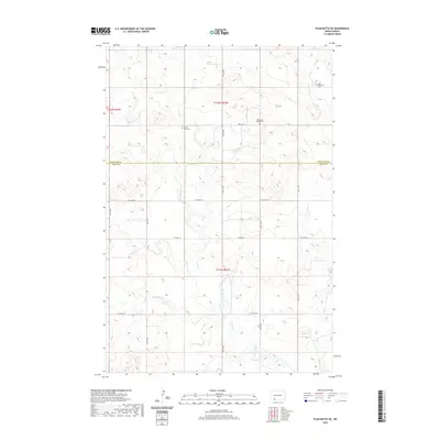
2020 Map of Plum Butte NE
USGS Topo · Published 2020About this map
The county line between Hettinger Co and Adams Co divides this quiet prairie landscape of southwestern North Dakota. The area's spiritual and family history is preserved in several rural burial sites, including the Sacred Heart Cem and Pilgerheim Baptist Cem, which anchor the sectioned grid. These sites, along with the Zoar Methodist Cem to the northeast, reflect the early settlement patterns of the region's agricultural communities. The terrain is defined by the winding paths of Timber Creek and Sheep Cr, which cut through the undulating plains. A network of section-line roads like Bentley Rd and 14th Ave NE provides the primary structure for the township and range system, typical of the state's rural development in the twenty-first century.
Find a feature on this map
23 named features on this map. Tap any name to fly to it.
Don’t see what you’re looking for? This feature index may not catch every label — zoom into the map to look around manually.
Map Details
Editions of this 2020 Plum Butte NE Map
This is the sole edition of this map. No revisions or reprints were ever made.
Other maps of this area

1953 · Dickinson
USGS Topo · 1:250,000

1954 · Bismarck
USGS Topo · 1:250,000

1957 · Dickinson
USGS Topo · 1:250,000

1958 · Bismarck
USGS Topo · 1:250,000

1969 · Burt
USGS Topo · 1:24,000

1969 · Bentley
USGS Topo · 1:24,000

1972 · Coffin Buttes
USGS Topo · 1:24,000

1972 · New Leipzig South
USGS Topo · 1:24,000

1972 · Round Top
USGS Topo · 1:24,000
1974 · Nason Hill
USGS Topo · 1:24,000