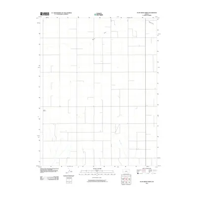
2010 Map of Plum Creek North
USGS Topo · Published 2010About this map
Mattox Draw and several intermittent watercourses define the high plains drainage of this corner of Hamilton County. The landscape is dominated by a precise section-line road network, including State Hwy 27 running north-south and lateral connectors such as Rd 7 and Rd 10. This pattern reflects the enduring structure of Great Plains land division, where transportation follows the grid of agricultural homesteads. Lewis Airport serves as a lone aviation landmark in this western Kansas reach, while Plum Creek and Sand Creek mark the natural contours of the terrain amidst the surrounding road-bound parcels.
Find a feature on this map
12 named features on this map. Tap any name to fly to it.
Don’t see what you’re looking for? This feature index may not catch every label — zoom into the map to look around manually.
Map Details
Editions of this 2010 Plum Creek North Map
This is the sole edition of this map. No revisions or reprints were ever made.
Other maps of this area

1955 · Scott City
USGS Topo · 1:250,000

1958 · Scott City
USGS Topo · 1:250,000
1966 · Tribune 3 SW
USGS Topo · 1:24,000

1966 · Tribune 4 NW
USGS Topo · 1:24,000
1966 · Tribune 3 SE
USGS Topo · 1:24,000
1966 · Tribune 3 NE
USGS Topo · 1:24,000
1966 · Tribune 4 SW
USGS Topo · 1:24,000
1966 · Tribune 3 NW
USGS Topo · 1:24,000

1970 · Selkirk SW
USGS Topo · 1:24,000

1970 · Tribune SE
USGS Topo · 1:24,000