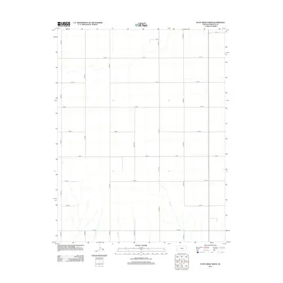
2012 Map of Plum Creek North
USGS Topo · Published 2012About this map
Plum Cr and Sand Cr cut through the southern landscape of this high plains region in western Hamilton County. The map reveals a strictly regulated section-line road system, where corridors such as Co Road J and Co Road N define the boundaries of large-scale agricultural tracts. Transverse routes like Co Road 7 and Co Road 10 intersect this grid, illustrating the methodical organization of Kansas farmland. The scarcity of named settlements highlights the area's rural character, where the topography is primarily shaped by these intermittent drainage channels and the persistent geometric network of county roads.
Find a feature on this map
17 named features on this map. Tap any name to fly to it.
Don’t see what you’re looking for? This feature index may not catch every label — zoom into the map to look around manually.
Map Details
Editions of this 2012 Plum Creek North Map
This is the sole edition of this map. No revisions or reprints were ever made.
Other maps of this area

1955 · Scott City
USGS Topo · 1:250,000

1958 · Scott City
USGS Topo · 1:250,000
1966 · Tribune 3 SW
USGS Topo · 1:24,000

1966 · Tribune 4 NW
USGS Topo · 1:24,000
1966 · Tribune 3 SE
USGS Topo · 1:24,000
1966 · Tribune 3 NE
USGS Topo · 1:24,000
1966 · Tribune 4 SW
USGS Topo · 1:24,000
1966 · Tribune 3 NW
USGS Topo · 1:24,000

1970 · Selkirk SW
USGS Topo · 1:24,000

1970 · Tribune SE
USGS Topo · 1:24,000