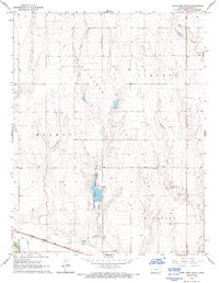
1966 Map of Plum Creek South
USGS Topo · Published 1993About this map
Hamilton County State Park serves as a central recreational and water feature in this western Kansas landscape, where the high plains meet the intricate drainage systems of Plum Creek and Syracuse Creek. The terrain is characterized by broad fields like Bradshaw Field and Medway, reflecting the agricultural and ranching patterns of the mid-1960s. In the southern portion of the map, the industrial and transport corridor follows the Arkansas River, where the Alamo Ditch highlights the critical role of water management in this arid region.
Find a feature on this map
21 named features on this map. Tap any name to fly to it.
Don’t see what you’re looking for? This feature index may not catch every label — zoom into the map to look around manually.
Map Details
Editions of this 1966 Plum Creek South Map
2 editions found
Other maps of this area

1900 · Syracuse
USGS Topo · 1:125,000

1920 · Syracuse
USGS Topo · 1:125,000

1955 · Dodge City
USGS Topo · 1:250,000

1955 · Scott City
USGS Topo · 1:250,000

1958 · Dodge City
USGS Topo · 1:250,000

1958 · Scott City
USGS Topo · 1:250,000

1959 · Dodge City
USGS Topo · 1:250,000
1966 · Tribune 3 SW
USGS Topo · 1:24,000

1966 · Syracuse East
USGS Topo · 1:24,000
1966 · Syracuse West
USGS Topo · 1:24,000