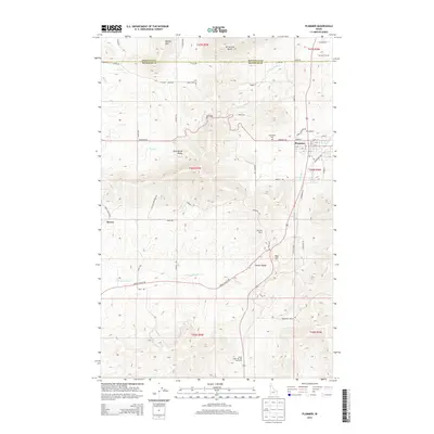
2013 Map of Plummer
USGS Topo · Published 2013About this map
Plummer serves as the primary hub for this region of North Idaho, where the residential street grid of the town site transitions into the complex drainage systems of the Palouse and Coeur d'Alene highlands. The landscape is defined by its deep topographical relief, including the prominent McCartney Butte and Minkler Mtn to the north, while the Rock Creek Valley and Lovell Valley provide more level ground for travel and settlement. Historic infrastructure is evident in the Sorrento Tunnel and the placement of the Evergreen Cem west of town. The map also records cultural and recreational landmarks like the Khwele' Grounds and the Chief Moc-Tel-Me Rest Area along the main highway corridor. To the west, the smaller settlement area of Mowry sits near the headwaters of Little Hangman Cr, illustrating the dispersed development typical of Benewah County's upland valleys.
Find a feature on this map
59 named features on this map. Tap any name to fly to it.
Don’t see what you’re looking for? This feature index may not catch every label — zoom into the map to look around manually.
Map Details
Editions of this 2013 Plummer Map
This is the sole edition of this map. No revisions or reprints were ever made.
Other maps of this area
1903 · Oakesdale
USGS Topo · 1:125,000
1905 · Oakesdale
USGS Topo · 1:125,000
1954 · Fairfield
USGS Topo · 1:62,500
1955 · Spokane
USGS Topo · 1:250,000
1957 · Plummer
USGS Topo · 1:62,500
1957 · Tensed
USGS Topo · 1:62,500
1958 · Spokane
USGS Topo · 1:250,000
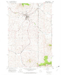
1964 · Tekoa
USGS Topo · 1:24,000
1975 · Plummer NW
USGS Topo · 1:24,000
1975 · Plummer SE
USGS Topo · 1:24,000