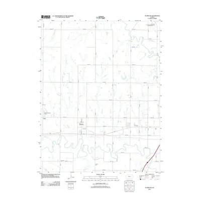
2012 Map of Plymouth
USGS Topo · Published 2012About this map
The Cottonwood River and Neosho River valley in Lyon County is captured here in 2012, showcasing a landscape defined by its grid-patterned rural roads and small agricultural centers. The settlement of Plymouth sits centrally along the east-west corridor of Highway 50, while Toledo occupies the western edge of the quadrangle. This area preserves numerous family and community burial grounds, including Cottonwood Cem, Hillside Cem, Grandview Cem, and Haworth Cem, providing essential locations for genealogical research. The geography is marked by a network of drainage creeks such as Beaver Cr, Linck Cr, and Moon Cr that feed into the larger river systems. Infrastructure like the Roberts Memorial Airport and the Americus Wastewater Treatment Facility near the northern boundary indicate the modern utility of this primarily rural region.
Find a feature on this map
49 named features on this map. Tap any name to fly to it.
Don’t see what you’re looking for? This feature index may not catch every label — zoom into the map to look around manually.
Map Details
Editions of this 2012 Plymouth Map
This is the sole edition of this map. No revisions or reprints were ever made.
Other maps of this area

1885 · Eskridge
USGS Topo · 1:125,000

1888 · Emporia
USGS Topo · 1:125,000

1889 · Eskridge
USGS Topo · 1:125,000

1894 · Emporia
USGS Topo · 1:125,000

1894 · Eskridge
USGS Topo · 1:125,000

1955 · Hutchinson
USGS Topo · 1:250,000

1957 · Emporia
USGS Topo · 1:24,000

1957 · Saffordville
USGS Topo · 1:24,000

1957 · Plymouth
USGS Topo · 1:24,000

1959 · Hutchinson
USGS Topo · 1:250,000