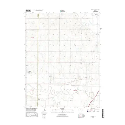
2015 Map of Plymouth
USGS Topo · Published 2015About this map
The winding Cottonwood River and Neosho River dominate this landscape on the border of Chase and Lyon Counties, where the prairie transitions into a network of creek-fed bottoms. The small community of Plymouth sits just north of the river, while Americus is positioned in the northeast corner near Troublesome Creek. This 2015 survey reveals a rural geography defined by its cemeteries and small-scale infrastructure, including Cottonwood Cemetery and the Roberts Memorial Airport located near Toledo. Numerous waterways like Beaver Creek, Lindy Creek, and Moon Creek carve through the sections, illustrating the drainage patterns that have historically shaped local agriculture and settlement. The grid of country roads, from Road 150 to 290 Road, provides a clear view of modern land divisions superimposed over the natural river bends.
Find a feature on this map
43 named features on this map. Tap any name to fly to it.
Don’t see what you’re looking for? This feature index may not catch every label — zoom into the map to look around manually.
Map Details
Editions of this 2015 Plymouth Map
This is the sole edition of this map. No revisions or reprints were ever made.
Other maps of this area

1885 · Eskridge
USGS Topo · 1:125,000

1888 · Emporia
USGS Topo · 1:125,000

1889 · Eskridge
USGS Topo · 1:125,000

1894 · Emporia
USGS Topo · 1:125,000

1894 · Eskridge
USGS Topo · 1:125,000

1955 · Hutchinson
USGS Topo · 1:250,000

1957 · Emporia
USGS Topo · 1:24,000

1957 · Saffordville
USGS Topo · 1:24,000

1957 · Plymouth
USGS Topo · 1:24,000

1959 · Hutchinson
USGS Topo · 1:250,000