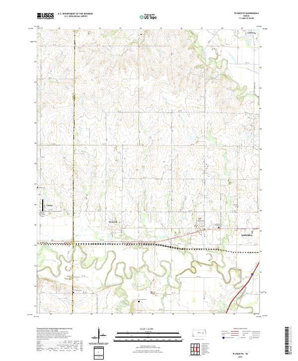
2022 Map of Plymouth
USGS Topo · Published 2022About this map
The Cottonwood River and Neosho River converge in this section of the Kansas plains, creating a landscape defined by meandering river bends and small creek tributaries. The settlement of Plymouth sits at the heart of this grid, surrounded by evidence of early community life and religious history. The presence of Cottonwood Friends Cem and Haworth Cem near the riverbanks suggests a long-standing Quaker and pioneer influence in the region.
Find a feature on this map
58 named features on this map. Tap any name to fly to it.
Don’t see what you’re looking for? This feature index may not catch every label — zoom into the map to look around manually.
Map Details
Editions of this 2022 Plymouth Map
This is the sole edition of this map. No revisions or reprints were ever made.
Other maps of this area

1885 · Eskridge
USGS Topo · 1:125,000

1888 · Emporia
USGS Topo · 1:125,000

1889 · Eskridge
USGS Topo · 1:125,000

1894 · Emporia
USGS Topo · 1:125,000

1894 · Eskridge
USGS Topo · 1:125,000

1955 · Hutchinson
USGS Topo · 1:250,000

1957 · Emporia
USGS Topo · 1:24,000

1957 · Saffordville
USGS Topo · 1:24,000

1957 · Plymouth
USGS Topo · 1:24,000

1959 · Hutchinson
USGS Topo · 1:250,000