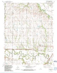
1989 Map of Plymouth
USGS Topo · Published 1990About this map
The Cottonwood River meanders sharply across this landscape, defining the topography of western Lyon County near the Chase County line. The small settlement of Plymouth sits just north of the river, while the community of Toledo appears further west. This area serves as a significant transportation corridor, where the Kansas Turnpike and a Toll Road parallel a heavy rail line marked as 3 Tracks. Local history is anchored by several rural landmarks, including the Saffordville Ch and Cottonwood Ch, as well as family-oriented burial grounds like Haworth Cem and Hillside Cem. In the northeastern corner, the Neosho River flows past the edge of Americus, highlighting the region's reliance on these major waterways for drainage and early development.
Find a feature on this map
29 named features on this map. Tap any name to fly to it.
Don’t see what you’re looking for? This feature index may not catch every label — zoom into the map to look around manually.
Map Details
Editions of this 1989 Plymouth Map
This is the sole edition of this map. No revisions or reprints were ever made.
Other maps of this area

1885 · Eskridge
USGS Topo · 1:125,000

1888 · Emporia
USGS Topo · 1:125,000

1889 · Eskridge
USGS Topo · 1:125,000

1894 · Emporia
USGS Topo · 1:125,000

1894 · Eskridge
USGS Topo · 1:125,000

1955 · Hutchinson
USGS Topo · 1:250,000

1957 · Emporia
USGS Topo · 1:24,000

1957 · Saffordville
USGS Topo · 1:24,000

1957 · Plymouth
USGS Topo · 1:24,000

1959 · Hutchinson
USGS Topo · 1:250,000