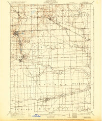
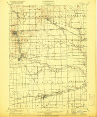
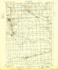
1905 Map of Plymouth
USGS Topo · Published 1932About this map
Farmington and Northville anchor this early 20th-century landscape, which is defined by an intricate network of electric railways that preceded the modern automotive era. The Orchard Lake Electric RR and the Detroit and Northville Electric RR carve through the townships, connecting smaller hubs like Clarenceville and Powers to the larger Detroit vicinity. This transition period is evident in the cluster of institutional landmarks, such as the Wayne County Home near Eloise, sitting alongside established rail lines like the Pere Marquette RR.
Find a feature on this map
59 named features on this map. Tap any name to fly to it.
Don’t see what you’re looking for? This feature index may not catch every label — zoom into the map to look around manually.
Map Details
Editions of this 1905 Plymouth Map
4 editions found

Historical Maps of Detroit Through Time
1 maps found