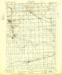
1905 Map of Wayne
USGS Topo · Published 1932About this map
The Rouge River and its various branches, including the Middle Rouge River and Lower River Rouge, define the geography of this Western Wayne County landscape during the early 1900s. The region is characterized by an evolving transportation network where traditional rail lines like the Pere Marquette RR intersect with modern transit of the era, such as the Detroit and Northville Electric RR. Settlements like Plymouth, Northville, and Dearborn appear as established hubs, while smaller vanished points such as Pikes Peak and Eloise provide specific touchpoints for local historians. This era shows a transition from rural townships like Nankin and Livonia toward the suburban expansion that would eventually follow, captured here before the heavy industrialization of the mid-20th century transformed these agrarian and early commuter corridors.
Find a feature on this map
56 named features on this map. Tap any name to fly to it.
Don’t see what you’re looking for? This feature index may not catch every label — zoom into the map to look around manually.
Map Details
Editions of this 1905 Wayne Map
4 editions found
Other maps of this area

1902 · South Lyon
USGS Topo · 1:62,500

1902 · Ypsilanti
USGS Topo · 1:62,500

1904 · Ann Arbor
USGS Topo · 1:125,000

1905 · Wayne
USGS Topo · 1:62,500

1905 · Detroit
USGS Topo · 1:62,500

1906 · Ypsilanti
USGS Topo · 1:62,500

1906 · Wyandotte
USGS Topo · 1:62,500

1906 · South Lyon
USGS Topo · 1:62,500

1906 · Romulus
USGS Topo · 1:62,500

1907 · Pontiac
USGS Topo · 1:62,500