
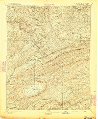
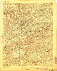
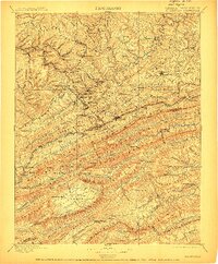
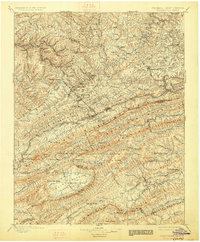
1895 Map of Pocahontas
USGS Topo · Published 1895About this map
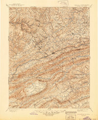
Coal mining and the railroad define the landscape along the West Virginia Virginia border in the 1890s. The expansion of the Norfolk and Western RR facilitates a string of industrial settlements through the Elkhorn Creek valley, including Keystone, North Fork, Elkhorn, and Maybeury. These boomtowns are situated amidst the steep relief of the Beartown Ridge and Garden Mountain, illustrating the era's intensive resource extraction.
Find a feature on this map
151 named features on this map. Tap any name to fly to it.
Don’t see what you’re looking for? This feature index may not catch every label — zoom into the map to look around manually.
Map Details
Editions of this 1895 Pocahontas Map
6 editions found
Other maps of this area

1887 · Pocahontas
USGS Topo · 1:125,000

1887 · Hinton
USGS Topo · 1:125,000

1889 · Hillsville
USGS Topo · 1:125,000

1889 · Wytheville
USGS Topo · 1:125,000

1890 · Dublin
USGS Topo · 1:125,000

1891 · Tazewell
USGS Topo · 1:125,000

1891 · Pocahontas
USGS Topo · 1:125,000

1891 · Dublin
USGS Topo · 1:125,000

1891 · Oceana
USGS Topo · 1:125,000

1891 · Abingdon
USGS Topo · 1:125,000