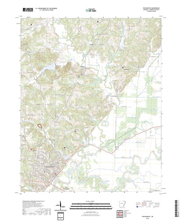
2024 Map of Pocahontas
USGS Topo · Published 2024About this map
Pocahontas and its surrounding river bottoms are defined by the winding course of the Black River and the Fourche River. The landscape transitions from the river valleys to the elevated terrain of Attica Hill and Aunt Lucy Hill, where small settlements like Attica and Stokes are situated. The area is heavily marked by its hydrology, featuring numerous sloughs and drainage systems such as Old River Slough, Deep Slough, and the Frisco Ditch. For genealogists and local researchers, the map identifies several burial sites, including Oak Grove Cem, Pettit Cem, and Harris Cem. The civic center of the region is anchored by the Randolph County Courthouse in the heart of town. Transportation history is evidenced by the presence of Old Skaggs Ferry on the Current River, reflecting the era when river crossings were vital for local commerce before modern bridge infrastructure dominated the Randolph County landscape.
Find a feature on this map
105 named features on this map. Tap any name to fly to it.
Don’t see what you’re looking for? This feature index may not catch every label — zoom into the map to look around manually.
Map Details
Editions of this 2024 Pocahontas Map
This is the sole edition of this map. No revisions or reprints were ever made.
Other maps of this area

1932 · Walnut Ridge
USGS Topo · 1:62,500

1934 · Powhatan
USGS Topo · 1:62,500

1935 · Powhatan
USGS Topo · 1:62,500

1935 · Reyno
USGS Topo · 1:62,500

1935 · Walnut Ridge
USGS Topo · 1:62,500

1957 · Poplar Bluff
USGS Topo · 1:250,000

1959 · Poplar Bluff
USGS Topo · 1:250,000

1960 · Poplar Bluff
USGS Topo · 1:250,000
1965 · O'Kean
USGS Topo · 1:24,000
1965 · Manson
USGS Topo · 1:24,000