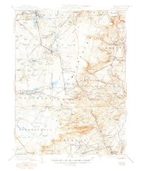
1923 Map of Pocono
USGS Topo · Published 1948About this map
Tobyhanna and the surrounding highlands of the Pocono plateau are defined here by a dense network of mountain lakes, vast swamps, and early twentieth-century resort infrastructure. The Delaware Lackawanna and Western RR cuts across the terrain, serving established settlements like Mount Pocono and the Pocono Summit. Extensive water bodies such as Stillwater Lake, Lake Naomi, and Gouldsboro Lake dominate the landscape, many of which supported the region's burgeoning recreation industry.
Find a feature on this map
157 named features on this map. Tap any name to fly to it.
Don’t see what you’re looking for? This feature index may not catch every label — zoom into the map to look around manually.
Map Details
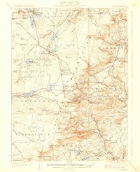
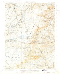
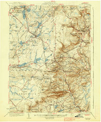
Editions of this 1923 Pocono Map
5 editions found

Other maps of this area

1889 · Scranton
USGS Topo · 1:62,500

1891 · Scranton
USGS Topo · 1:62,500

1891 · Delaware Water Gap
USGS Topo · 1:62,500

1893 · Delaware Water Gap
USGS Topo · 1:62,500

1893 · Scranton
USGS Topo · 1:62,500

1914 · Wind Gap
USGS Topo · 1:62,500

1916 · Wind Gap
USGS Topo · 1:62,500

1919 · Pocono
USGS Topo · 1:62,500

1921 · Pocono
USGS Topo · 1:62,500

1922 · Mauch Chunk
USGS Topo · 1:62,500