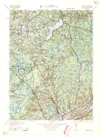
1959 Map of Pocono
USGS Topo · Published 1959About this map
Lake Wallenpaupack dominates the upper-central portion of this landscape, a significant reservoir in the heart of the Pocono Mountains. This survey, compiled from work by the War Department and U.S. Geological Survey, illustrates a mid-century period when rural schoolhouses and small-town churches still formed the backbone of local communities. Local history is preserved in the placement of the Millertown School and Bartonsville School, as well as the numerous camps like Camp Tegawitha and Camp Owaissa that highlight the region's burgeoning recreational identity.
Find a feature on this map
137 named features on this map. Tap any name to fly to it.
Don’t see what you’re looking for? This feature index may not catch every label — zoom into the map to look around manually.
Map Details
Editions of this 1959 Pocono Map
This is the sole edition of this map. No revisions or reprints were ever made.
Other maps of this area

1888 · Hackettstown
USGS Topo · 1:62,500

1889 · Scranton
USGS Topo · 1:62,500

1891 · Wallpack
USGS Topo · 1:62,500

1891 · Scranton
USGS Topo · 1:62,500

1891 · Delaware Water Gap
USGS Topo · 1:62,500

1892 · Honesdale
USGS Topo · 1:62,500

1892 · Dundaff
USGS Topo · 1:62,500

1893 · Delaware Water Gap
USGS Topo · 1:62,500

1893 · Scranton
USGS Topo · 1:62,500

1893 · Wallpack
USGS Topo · 1:62,500
Featured Places
- Tobyhanna, Coolbaugh Township
- Blairstown, NJ
- Lackawaxen Township, PA
- Blooming Grove Township, PA
- Mount Pocono, PA