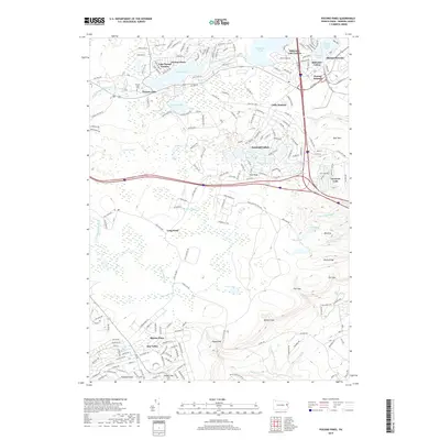
2019 Map of Pocono Pines
USGS Topo · Published 2019About this map
Pocono Pines and the surrounding resort communities of the Pocono Plateau reflect a landscape defined by seasonal residency and mid-century suburban expansion. The 2019 survey details the dense street networks of Lake Naomi Estates, Stillwater Lake Estates, and Emerald Lakes, which encircle the region's prominent glacial and man-made water bodies. This area is a patchwork of planned developments and preserved woodlands, where the headwaters of Tunkhannock Creek and Swiftwater Cr drain the high ground between Mount Pocono and Pocono Summit.
Find a feature on this map
53 named features on this map. Tap any name to fly to it.
Don’t see what you’re looking for? This feature index may not catch every label — zoom into the map to look around manually.
Map Details
Editions of this 2019 Pocono Pines Map
This is the sole edition of this map. No revisions or reprints were ever made.
Other maps of this area

1914 · Wind Gap
USGS Topo · 1:62,500

1916 · Wind Gap
USGS Topo · 1:62,500

1919 · Pocono
USGS Topo · 1:62,500

1921 · Pocono
USGS Topo · 1:62,500

1922 · Mauch Chunk
USGS Topo · 1:62,500

1922 · Stoddartsville
USGS Topo · 1:62,500

1923 · Pocono
USGS Topo · 1:62,500

1924 · Stoddartsville
USGS Topo · 1:62,500

1924 · Mauch Chunk
USGS Topo · 1:62,500

1943 · Scranton
USGS Topo · 1:125,000
Featured Places
- Pocono Summit, Tobyhanna Township
- Long Pond, Tunkhannock Township
- Pocono Pines, Tobyhanna Township
- Emerald Lakes, PA
- Pocono Township, PA