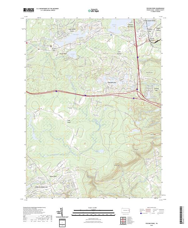
2023 Map of Pocono Pines
USGS Topo · Published 2023About this map
Lake Naomi Estates and Stillwater Lake Estates define the residential character of this modern landscape, where extensive development surrounds glacial water bodies in the Poconos. The intricate street networks of Pocono Pines and Sierra View illustrate the area's continued growth as a recreational and residential hub. Beyond the developed lakefronts, the terrain rises toward Camelback Mtn and Bear Mountain, where the topography is broken by prominent natural gaps such as Hypsy Gap and Bowers Gap. Hydrological patterns are dominated by the Tunkhannock Creek and its various tributaries, including Upper Tunkhannock Creek and Mud Pond Run. Local genealogy and history are anchored by the Pocono Lake Cem near the northern shore of Pocono Lake, providing a point of continuity amidst the modern estates and resort communities.
Find a feature on this map
55 named features on this map. Tap any name to fly to it.
Don’t see what you’re looking for? This feature index may not catch every label — zoom into the map to look around manually.
Map Details
Editions of this 2023 Pocono Pines Map
This is the sole edition of this map. No revisions or reprints were ever made.
Other maps of this area

1914 · Wind Gap
USGS Topo · 1:62,500

1916 · Wind Gap
USGS Topo · 1:62,500

1919 · Pocono
USGS Topo · 1:62,500

1921 · Pocono
USGS Topo · 1:62,500

1922 · Mauch Chunk
USGS Topo · 1:62,500

1922 · Stoddartsville
USGS Topo · 1:62,500

1923 · Pocono
USGS Topo · 1:62,500

1924 · Stoddartsville
USGS Topo · 1:62,500

1924 · Mauch Chunk
USGS Topo · 1:62,500

1943 · Scranton
USGS Topo · 1:125,000
Featured Places
- Chestnuthill Township, PA
- Pocono Summit, Tobyhanna Township
- Long Pond, Tunkhannock Township
- Pocono Lake, Pocono Pines
- Coolbaugh Township, PA