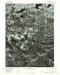
1976 Map of Pocono Pines
USGS Topo · Published 1978About this map
Pocono Pines and its surrounding wetlands and woodlands are captured here during the mid-1970s, a period when the Monroe County landscape was increasingly defined by a mix of recreational water bodies and expanding road networks. This orthophotoquad, produced from 1976 aerial photography, provides a stark visual record of the clearings and residential footprints emerging among the dense forest cover. The map highlights the significant presence of Pocono Lake to the northwest and Crescent Lake to the east, illustrating the lake-centered development patterns typical of the region. Local land use is further evidenced by the smaller Grass Lake and the various cleared tracts that suggest agricultural or early-stage development efforts near the community core.
Find a feature on this map
4 named features on this map. Tap any name to fly to it.
Don’t see what you’re looking for? This feature index may not catch every label — zoom into the map to look around manually.
Map Details
Editions of this 1976 Pocono Pines Map
This is the sole edition of this map. No revisions or reprints were ever made.
Other maps of this area

1914 · Wind Gap
USGS Topo · 1:62,500

1916 · Wind Gap
USGS Topo · 1:62,500

1919 · Pocono
USGS Topo · 1:62,500

1921 · Pocono
USGS Topo · 1:62,500

1922 · Mauch Chunk
USGS Topo · 1:62,500

1922 · Stoddartsville
USGS Topo · 1:62,500

1923 · Pocono
USGS Topo · 1:62,500

1924 · Stoddartsville
USGS Topo · 1:62,500

1924 · Mauch Chunk
USGS Topo · 1:62,500

1943 · Scranton
USGS Topo · 1:125,000
Featured Places
- Pocono Pines, Tobyhanna Township
- Pocono Pines, Tobyhanna Township
- Long Pond, Tunkhannock Township
- Chestnuthill Township, PA
- Tobyhanna Township, PA