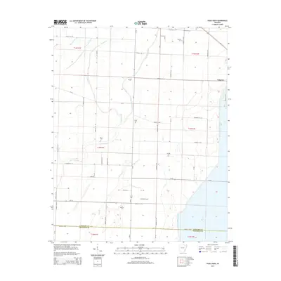
2014 Map of Podo Creek
USGS Topo · Published 2014About this map
Sedgwick stands as a focal point in this portion of Lawrence County, situated near the northeastern edge of a landscape defined by an intricate network of waterways and drainage sloughs. The topography is shaped by Podo Cr and Lick Pond Slough, which weave through the agricultural grid. This 2014 survey reveals a region with a strong genealogical footprint, evidenced by numerous small burial sites scattered across the township lines, including Markham Cem near the southern border and Arnold Cem toward the center. The settlement of Promised Land sits further south along Ar-230, reflecting the persistent rural community structure of northeastern Arkansas. The boundary between Lawrence County and Craighead County is clearly delineated at the southern margin, marking the transition into t14n r1e.
Find a feature on this map
58 named features on this map. Tap any name to fly to it.
Don’t see what you’re looking for? This feature index may not catch every label — zoom into the map to look around manually.
Map Details
Editions of this 2014 Podo Creek Map
This is the sole edition of this map. No revisions or reprints were ever made.
Other maps of this area

1932 · Walnut Ridge
USGS Topo · 1:62,500

1934 · Powhatan
USGS Topo · 1:62,500

1935 · Powhatan
USGS Topo · 1:62,500

1935 · Sedgwick
USGS Topo · 1:62,500

1935 · Alicia
USGS Topo · 1:62,500

1935 · Walnut Ridge
USGS Topo · 1:62,500

1953 · Memphis
USGS Topo · 1:250,000

1956 · Memphis
USGS Topo · 1:250,000

1957 · Poplar Bluff
USGS Topo · 1:250,000

1959 · Poplar Bluff
USGS Topo · 1:250,000