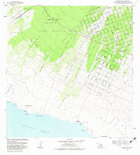
1981 Map of Pohue Bay
USGS Topo · Published 1983About this map
Manuka State Park and the sprawling Manuka Forest Reserve dominate the northern portion of this South Kona and Kau District coastline, where the landscape is defined by the intersection of volcanic activity and modern subdivision planning. Evidence of the island's geological history is etched across the terrain in the Lava Flow of 1887 and the Lava Flow of 1907, which flank a complex grid of residential streets including Aloha Boulevard and Ocean View Parkway. Along the rugged shoreline, ancient and modern history coexist; Petroglyphs are marked near the coast, while the Manuka Mauka House (Site) and a Grave provide specific points of interest for genealogists and local historians. The map also identifies several kipukas—islands of older land surrounded by more recent flows—such as Kipuka Kanohina and Kipuka Kamiloaina, which preserved pockets of vegetation amidst the basalt.
Find a feature on this map
89 named features on this map. Tap any name to fly to it.
Don’t see what you’re looking for? This feature index may not catch every label — zoom into the map to look around manually.
Map Details
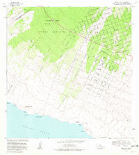
Editions of this 1981 Pohue Bay Map
2 editions found
Other maps of this area

1924 · Kalae
USGS Topo · 1:62,500

1924 · Honuapo
USGS Topo · 1:62,500

1928 · Hoopuloa
USGS Topo · 1:62,500

1954 · Hawaii South
USGS Topo · 1:250,000

1959 · Hawaii South
USGS Topo · 1:250,000

1961 · Hawaii South
USGS Topo · 1:250,000

1962 · Hawaii South
USGS Topo · 1:250,000

1962 · Milolii
USGS Topo · 1:24,000

1962 · Puu Hou
USGS Topo · 1:24,000

1962 · Kahuku Ranch
USGS Topo · 1:24,000