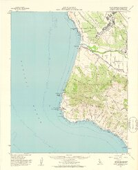
1959 Map of Point Arguello
USGS Topo · Published 1961About this map
Vandenberg Air Force Base and the U S Naval Missile Facility Point Arguello dominate this coastal section of Santa Barbara County during the Cold War era. The map details a landscape transitioning from traditional ranching and agriculture to high-tech military defense, evidenced by the presence of a Radio Tower (KNEZ) and the Branch U S Disciplinary Barracks. The Southern Pacific railroad follows the shoreline past small stops like Surf, Honda, and Arlight, while the historic Lompoc Landing (Site) marks an earlier era of maritime activity.
Find a feature on this map
66 named features on this map. Tap any name to fly to it.
Don’t see what you’re looking for? This feature index may not catch every label — zoom into the map to look around manually.
Map Details
Editions of this 1959 Point Arguello Map
2 editions found
Other maps of this area

1905 · Guadalupe
USGS Topo · 1:125,000

1905 · Lompoc
USGS Topo · 1:125,000

1942 · Point Arguello
USGS Topo · 1:62,500

1942 · Guadalupe
USGS Topo · 1:125,000

1942 · Lompoc
USGS Topo · 1:125,000

1942 · Lompoc
USGS Topo · 1:62,500

1942 · Pt. Conception
USGS Topo · 1:62,500

1942 · Santa Maria
USGS Topo · 1:62,500

1942 · Point Sal
USGS Topo · 1:62,500

1943 · Lompoc
USGS Topo · 1:125,000