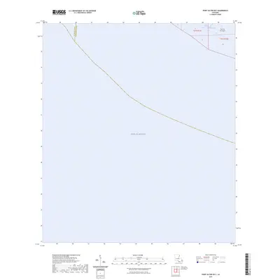
2024 Map of Point au Fer OE S
USGS Topo · Published 2024About this map
The Gulf of Mexico dominates this coastal landscape where the waters meet the southern reaches of Louisiana. The transition from open water to marshland is marked by the presence of Point Au Fer Island, a significant landform at the edge of the continental shelf. Internal waterways like Burkes Bayou provide a glimpse into the hydrographic network that defines the boundary between St. Mary Parish and Terrebonne Parish. Because the available elevation data did not meet accuracy requirements, this recent survey lacks traditional contour lines, emphasizing the extremely low-lying and fluid nature of this maritime environment. The map details the Public Land Survey System divisions, including t21s r11e and t21s r12e, which serve as the primary spatial reference for property and historical research in this remote coastal reach.
Find a feature on this map
10 named features on this map. Tap any name to fly to it.
Don’t see what you’re looking for? This feature index may not catch every label — zoom into the map to look around manually.
Map Details
Editions of this 2024 Point au Fer OE S Map
This is the sole edition of this map. No revisions or reprints were ever made.
Other maps of this area

1932 · Lake Decade
USGS Topo · 1:62,500

1935 · Oyster Bayou
USGS Topo · 1:62,500

1945 · New Orleans
USGS Topo · 1:250,000

1957 · Lake Decade
USGS Topo · 1:62,500
1957 · Oyster Bayou
USGS Topo · 1:62,500

1957 · Point Au Fer
USGS Topo · 1:62,500

1963 · New Orleans
USGS Topo · 1:250,000

1966 · New Orleans
USGS Topo · 1:250,000
1970 · Point Au Fer
USGS Topo · 1:24,000
1974 · Fourleague Bay
USGS Topo · 1:24,000