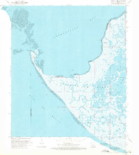
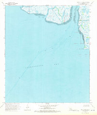
1970 Map of Point Au Fer
USGS Topo · Published 1971About this map
Point Au Fer Island sits at the volatile threshold of Atchafalaya Bay and the Gulf of Mexico, a coastal landscape defined by shifting marshlands and tidal channels in 1970. This survey captures the region's mid-century industrial character, dominated by the Locust Bayou Oil Field and a complex network of pipelines and canals carved through the wetlands. The coastline is marked by distinctive features such as Point Au Fer Shell Reef and Dead Alligator Point, reflecting both the biological and geological history of the Louisiana coast. Small rises in the marsh, notably Little Hammock and Narrow Hammock, provide rare relief in an area otherwise governed by the flow of Locust Bayou and Alligator Bayou. Further offshore, the presence of a lighthouse and radio tower on Eugene Island signals the importance of this stretch of water for navigation and coastal monitoring.
Find a feature on this map
29 named features on this map. Tap any name to fly to it.
Don’t see what you’re looking for? This feature index may not catch every label — zoom into the map to look around manually.
Map Details
Editions of this 1970 Point Au Fer Map
3 editions found
Other maps of this area

1932 · Lake Decade
USGS Topo · 1:62,500

1935 · Oyster Bayou
USGS Topo · 1:62,500

1945 · New Orleans
USGS Topo · 1:250,000

1957 · Lake Decade
USGS Topo · 1:62,500
1957 · Oyster Bayou
USGS Topo · 1:62,500

1957 · Point Au Fer
USGS Topo · 1:62,500

1963 · New Orleans
USGS Topo · 1:250,000

1966 · New Orleans
USGS Topo · 1:250,000
1970 · Point Au Fer NE
USGS Topo · 1:24,000
1974 · Plumb Bayou
USGS Topo · 1:24,000