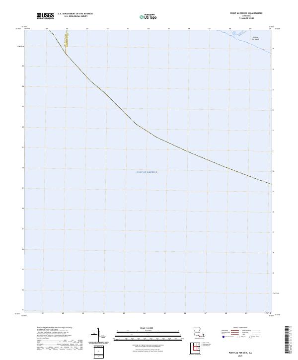
2025 Map of Point au Fer OE S
USGS Topo · Published 2025About this map
The coastal waters of the Gulf of America meet the marshy fringe of the Louisiana coastline in this maritime survey. Centered on the boundary where St. Mary Parish meets Terrebonne Parish, the map captures a landscape almost entirely defined by water and shifting sediment. In the northeast corner, a portion of Point Au Fer Island is visible, separated from the open gulf by the small passage of Burkes Bayou. This chart reflects the contemporary state of Louisiana's fragile shoreline, where landmasses are sparse and parish lines extend into open water. The lack of interior features emphasizes the marine nature of this environment, focusing specifically on the navigational interface between the gulf and the outer islands.
Find a feature on this map
4 named features on this map. Tap any name to fly to it.
Don’t see what you’re looking for? This feature index may not catch every label — zoom into the map to look around manually.
Map Details
Editions of this 2025 Point au Fer OE S Map
This is the sole edition of this map. No revisions or reprints were ever made.
Other maps of this area

1932 · Lake Decade
USGS Topo · 1:62,500

1935 · Oyster Bayou
USGS Topo · 1:62,500

1945 · New Orleans
USGS Topo · 1:250,000

1957 · Lake Decade
USGS Topo · 1:62,500
1957 · Oyster Bayou
USGS Topo · 1:62,500

1957 · Point Au Fer
USGS Topo · 1:62,500

1963 · New Orleans
USGS Topo · 1:250,000

1966 · New Orleans
USGS Topo · 1:250,000
1970 · Point Au Fer
USGS Topo · 1:24,000
1974 · Fourleague Bay
USGS Topo · 1:24,000