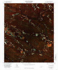
1980 Map of Point Caswell
USGS Topo · Published 1985About this map
Black River and Cape Fear River define the hydraulic character of this 1980 color infrared orthophotoquad, which reveals the dense forested wetlands and agricultural clearings of Pender County. The settlement at Point Caswell sits near the river's edge, reflecting its history as a river-dependent community. The orthophoto format provides a clear view of land-use patterns during the early 1980s, showing the exact boundaries of fields and timber tracts near Long View and the swampy bottomlands of Buckle Swamp. Waterways like Colly Creek and Lyon Creek snake through the terrain, illustrating the natural drainage systems that have historically dictated where residents could build at Still Bluff and Rooks.
Find a feature on this map
10 named features on this map. Tap any name to fly to it.
Don’t see what you’re looking for? This feature index may not catch every label — zoom into the map to look around manually.
Map Details
Editions of this 1980 Point Caswell Map
This is the sole edition of this map. No revisions or reprints were ever made.
Other maps of this area

1953 · Florence
USGS Topo · 1:250,000

1954 · Florence
USGS Topo · 1:250,000

1954 · White Lake
USGS Topo · 1:62,500

1954 · Acme
USGS Topo · 1:62,500

1954 · Bolton
USGS Topo · 1:62,500

1955 · Atkinson
USGS Topo · 1:62,500
1980 · Acme
USGS Topo · 1:24,000
1980 · Leland
USGS Topo · 1:24,000
1980 · Currie
USGS Topo · 1:24,000

1982 · Elizabethtown
USGS Topo · 1:100,000