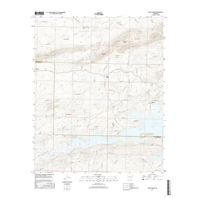
2017 Map of Point Cedar
USGS Topo · Published 2017About this map
Point Cedar serves as the central hub of this topographical survey, situated at the crossroads of Point Cedar Rd and Shouse Ford Rd. The landscape is defined by the sharp transition from the elevated peaks of the Point Cedar Mountains, Trap Mtn, and Emory Mill Mtn in the north to the sprawling waters of De Gray Lake in the southeast. This artificial reservoir, fed by Point Cedar Cr and Yancey Cr, dominates the lower portion of the map, illustrating the significant hydrological engineering that reshaped the region's valleys.
Find a feature on this map
78 named features on this map. Tap any name to fly to it.
Don’t see what you’re looking for? This feature index may not catch every label — zoom into the map to look around manually.
Map Details
Editions of this 2017 Point Cedar Map
This is the sole edition of this map. No revisions or reprints were ever made.
Other maps of this area

1943 · Antoine
USGS Topo · 1:62,500

1955 · Little Rock
USGS Topo · 1:250,000

1956 · Little Rock
USGS Topo · 1:250,000

1960 · Little Rock
USGS Topo · 1:250,000

1964 · Little Rock
USGS Topo · 1:250,000

1966 · Pearcy
USGS Topo · 1:24,000

1966 · Hempwallace
USGS Topo · 1:24,000
1966 · Bonnerdale
USGS Topo · 1:24,000
1966 · Point Cedar
USGS Topo · 1:24,000
1966 · Bismarck
USGS Topo · 1:24,000