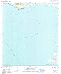
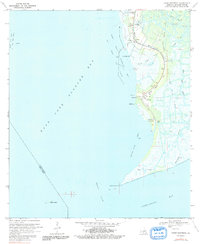
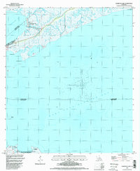
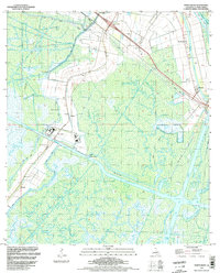
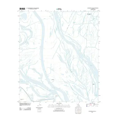
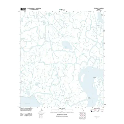
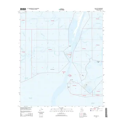
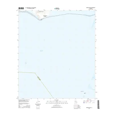
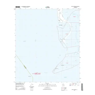
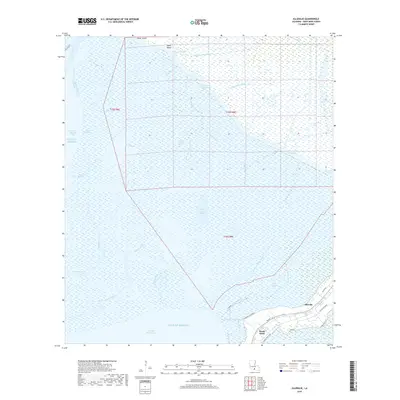
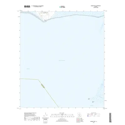
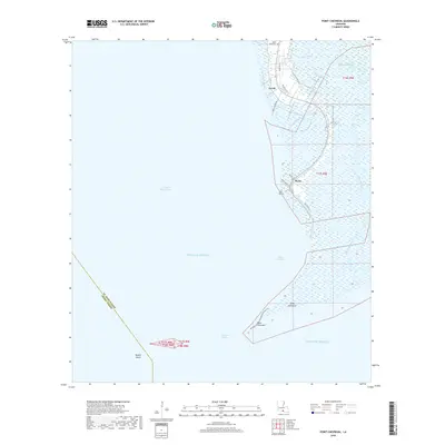
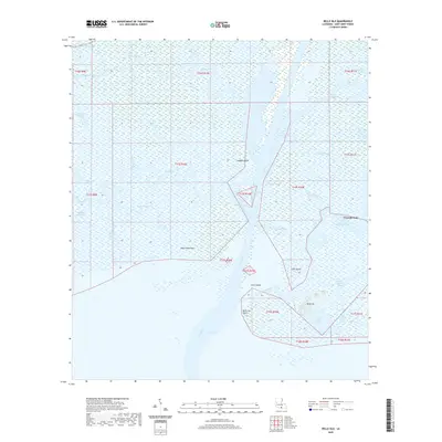
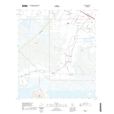
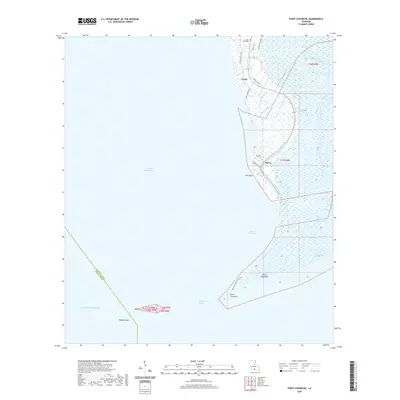
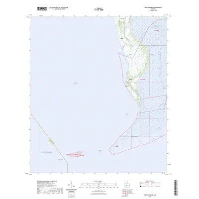
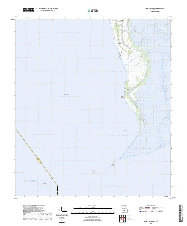
1970 Map of Point Chevreuil
USGS Topo · Published 1972About this map
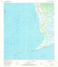
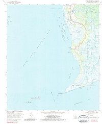
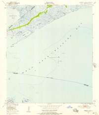
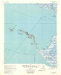
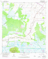
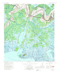
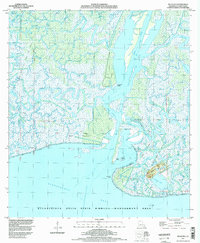
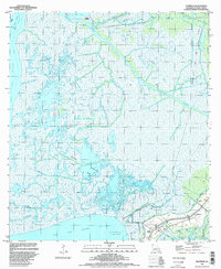
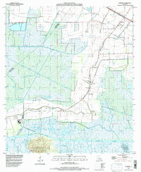
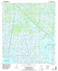
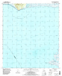
The coastal marshlands of St. Mary Parish meet the waters of East Cote Blanche Bay and Atchafalaya Bay in this 1970 survey. The landscape is defined by the extraction economy and the tidal influence of the Gulf, with the East Cote Blanche Bay Oil and Gas Field and several offshore platforms marking the transition from land to sea. Settlements like Gordy, Luke Landing, and Burns follow the high ground along the winding course of Bayou Sale, where the South Bend Cem stands near the northern edge. Significant terrain features include the distinct projection of Point Chevreuil and the isolated Rabbit Island to the west. The map also captures the intricate network of wetlands, naming Tucky Hammock, Salt Point, and numerous waterways such as Leopard Bayou and Horseshoe Bayou, illustrating the complex drainage patterns of the Louisiana coast before modern shoreline shifts.
Find a feature on this map
32 named features on this map. Tap any name to fly to it.
Don’t see what you’re looking for? This feature index may not catch every label — zoom into the map to look around manually.
Map Details
Editions of this 1970 Point Chevreuil Map
3 editions found
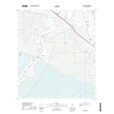
Historical Maps of Burns Through Time
77 maps found

1935 Belle Isle
St. Mary Parish, LA

1937 Bayou Sale
St. Mary Parish, LA

1941 Belle Isle
St. Mary Parish, LA
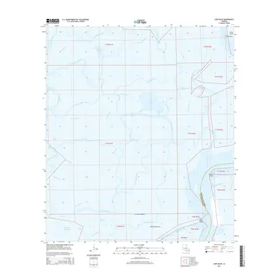
1949 Hammock Lake
St. Mary Parish, LA

1954 Belle Isle
St. Mary Parish, LA

1957 Bayou Sale
St. Mary Parish, LA
1957 Point Au Fer
St. Mary Parish, LA
1963 Kemper
St. Mary Parish, LA
1966 Belle Isle
St. Mary Parish, LA
1966 Lake Salve
St. Mary Parish, LA
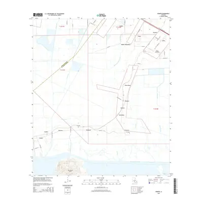
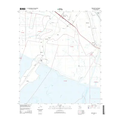
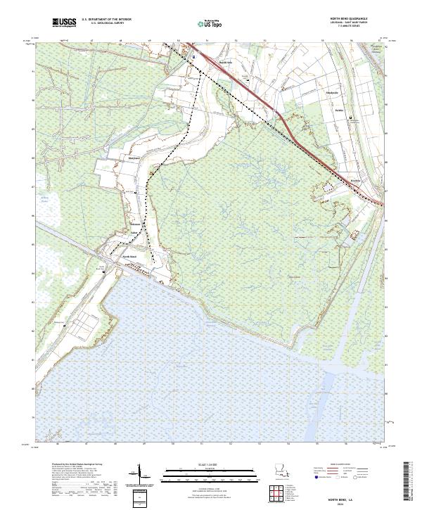
1966 North Bend
St. Mary Parish, LA
1967 Belle Isle
St. Mary Parish, LA
1968 Hammock Lake
St. Mary Parish, LA
1970 Centerville NW
St. Mary Parish, LA
1970 Ellerslie
St. Mary Parish, LA
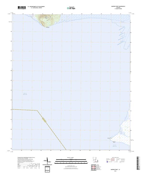
1970 Marone Point
St. Mary Parish, LA
1970 Point Chevreuil
St. Mary Parish, LA
1994 Belle Isle
St. Mary Parish, LA
1994 Ellerslie
St. Mary Parish, LA
1994 Hammock Lake
St. Mary Parish, LA
1994 Kemper
St. Mary Parish, LA
1994 Lake Salve
St. Mary Parish, LA
1994 Marone Point
St. Mary Parish, LA
1994 North Bend
St. Mary Parish, LA
1994 Point Chevreuil
St. Mary Parish, LA
1998 Belle Isle
St. Mary Parish, LA
2012 Belle Isle
St. Mary Parish, LA
2012 Centerville NW
St. Mary Parish, LA
2012 Ellerslie
St. Mary Parish, LA
2012 Hammock Lake
St. Mary Parish, LA
2012 Kemper
St. Mary Parish, LA
2012 Lake Salve
St. Mary Parish, LA
2012 Marone Point
St. Mary Parish, LA
2012 North Bend
St. Mary Parish, LA
2012 Point Chevreuil
St. Mary Parish, LA
2015 Belle Isle
St. Mary Parish, LA
2015 Centerville NW
St. Mary Parish, LA
2015 Ellerslie
St. Mary Parish, LA
2015 Hammock Lake
St. Mary Parish, LA
2015 Kemper
St. Mary Parish, LA
2015 Lake Salve
St. Mary Parish, LA
2015 Marone Point
St. Mary Parish, LA
2015 North Bend
St. Mary Parish, LA
2015 Point Chevreuil
St. Mary Parish, LA
2015 South of Belle Isle
St. Mary Parish, LA
2018 Belle Isle
St. Mary Parish, LA
2018 Centerville NW
St. Mary Parish, LA
2018 Ellerslie
St. Mary Parish, LA
2018 Hammock Lake
St. Mary Parish, LA
2018 Kemper
St. Mary Parish, LA
2018 Lake Salve
St. Mary Parish, LA
2018 Marone Point
St. Mary Parish, LA
2018 North Bend
St. Mary Parish, LA
2018 Point Chevreuil
St. Mary Parish, LA
2018 South of Belle Isle
St. Mary Parish, LA
2020 Belle Isle
St. Mary Parish, LA
2020 Centerville NW
St. Mary Parish, LA
2020 Ellerslie
St. Mary Parish, LA
2020 Hammock Lake
St. Mary Parish, LA
2020 Kemper
St. Mary Parish, LA
2020 Lake Salve
St. Mary Parish, LA
2020 Marone Point
St. Mary Parish, LA
2020 North Bend
St. Mary Parish, LA
2020 Point Chevreuil
St. Mary Parish, LA
2020 South of Belle Isle
St. Mary Parish, LA
2024 Belle Isle
St. Mary Parish, LA
2024 Centerville NW
St. Mary Parish, LA
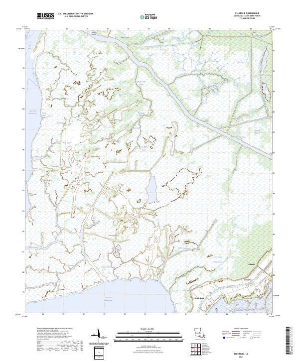
2024 Ellerslie
St. Mary Parish, LA
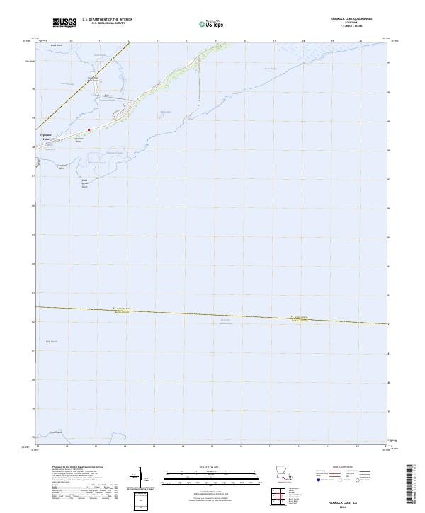
2024 Hammock Lake
St. Mary Parish, LA
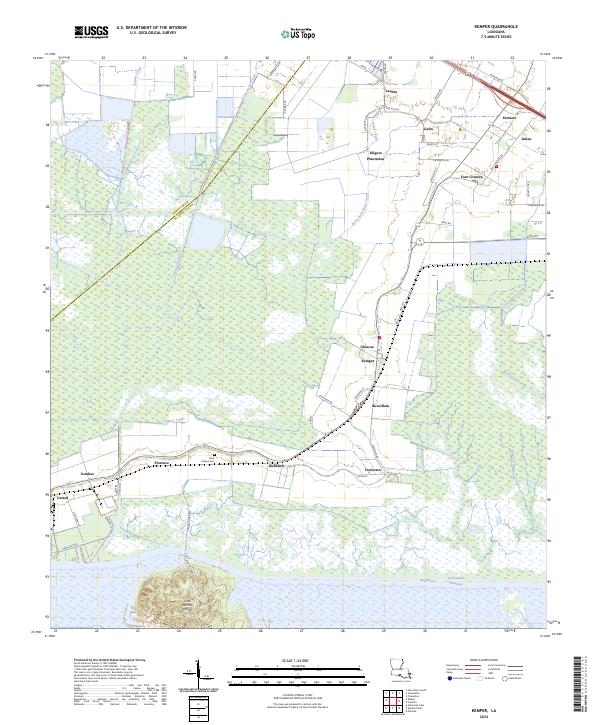
2024 Kemper
St. Mary Parish, LA
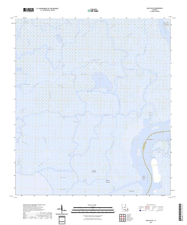
2024 Lake Salve
St. Mary Parish, LA
2024 Marone Point
St. Mary Parish, LA
2024 North Bend
St. Mary Parish, LA
2024 Point Chevreuil
St. Mary Parish, LA
2024 South of Belle Isle
St. Mary Parish, LA
2025 Point Chevreuil
St. Mary Parish, LA
2025 South of Belle Isle
St. Mary Parish, LA