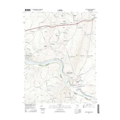
2014 Map of Point of Rocks
USGS Topo · Published 2014About this map
Catoctin Creek winds through a landscape of established settlements and small farming communities as they appeared in the early 21st century. The map centers on the border between Maryland and Virginia, defined by the Potomac River and the preserved corridor of the Chesapeake and Ohio Canal National Historical Park. Along this historic waterway, the Catoctin Creek Aqueduct stands as a notable piece of civil engineering, while the B & O RR parallels the river, meeting at the rail hub of Washington Junction. Local heritage is anchored by numerous churchyards and burial grounds, including Saint Marys Cem and Saint Marks Cem near Petersville. From the industrial legacy of Furnace Mtn to the residential growth in Potomac Village, the survey documents the evolution of a region where transportation routes like the Jefferson Pike have long shaped the local economy.
Find a feature on this map
149 named features on this map. Tap any name to fly to it.
Don’t see what you’re looking for? This feature index may not catch every label — zoom into the map to look around manually.
Map Details
Editions of this 2014 Point of Rocks Map
This is the sole edition of this map. No revisions or reprints were ever made.
Other maps of this area

1884 · Harpers Ferry
USGS Topo · 1:125,000

1891 · Harpers Ferry
USGS Topo · 1:125,000

1893 · Frederick
USGS Topo · 1:125,000

1893 · Harpers Ferry
USGS Topo · 1:125,000

1894 · Frederick
USGS Topo · 1:125,000

1908 · Middletown
USGS Topo · 1:48,000

1908 · Seneca
USGS Topo · 1:62,500

1908 · Ijamsville
USGS Topo · 1:62,500

1909 · Ijamsville
USGS Topo · 1:62,500

1910 · Antietam
USGS Topo · 1:62,500