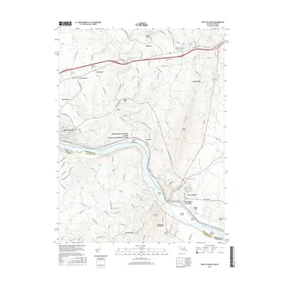
2016 Map of Point of Rocks
USGS Topo · Published 2016About this map
The Potomac River corridor at the intersection of Maryland and Virginia defines this landscape, where the Chesapeake and Ohio Canal National Historical Park follows the northern bank. This riverine economy is physically marked by engineering landmarks like the Catoctin Creek Aqueduct near Lander. The geography of the region is anchored by the ridge of Catoctin Mtn and the prominent Furnace Mtn, with the B & O RR running through Washington Junction and Point of Rocks. For genealogists and local researchers, the map provides precise locations for numerous burial grounds, including the Jefferson Union Cem, Saint Pauls Cem, and Furnace Mountain Cem. Smaller hamlets like Slabtown, Olive, and Petersville are shown alongside larger hubs like Brunswick, illustrating the varied settlement patterns of Frederick and Loudoun counties.
Find a feature on this map
144 named features on this map. Tap any name to fly to it.
Don’t see what you’re looking for? This feature index may not catch every label — zoom into the map to look around manually.
Map Details
Editions of this 2016 Point of Rocks Map
This is the sole edition of this map. No revisions or reprints were ever made.
Other maps of this area

1884 · Harpers Ferry
USGS Topo · 1:125,000

1891 · Harpers Ferry
USGS Topo · 1:125,000

1893 · Frederick
USGS Topo · 1:125,000

1893 · Harpers Ferry
USGS Topo · 1:125,000

1894 · Frederick
USGS Topo · 1:125,000

1908 · Middletown
USGS Topo · 1:48,000

1908 · Seneca
USGS Topo · 1:62,500

1908 · Ijamsville
USGS Topo · 1:62,500

1909 · Ijamsville
USGS Topo · 1:62,500

1910 · Antietam
USGS Topo · 1:62,500