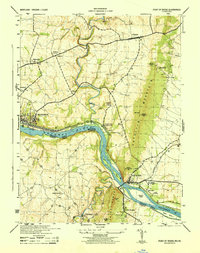
1944 Map of Point Of Rocks
USGS Topo · Published 1944About this map
The Potomac River corridor serves as the primary artery for both transportation and industry in this 1944 survey, where the Baltimore and Ohio Canal and the Baltimore and Ohio railroad trace the narrow strip of land between the water and the rising slopes of Catoctin Mountain. In Brunswick, the extensive rail infrastructure is clearly defined, while smaller river crossings and stops like Catoctin Sta (Lander P O) and Point of Rocks emphasize the era's reliance on these transit networks.
Find a feature on this map
35 named features on this map. Tap any name to fly to it.
Don’t see what you’re looking for? This feature index may not catch every label — zoom into the map to look around manually.
Map Details
Editions of this 1944 Point Of Rocks Map
This is the sole edition of this map. No revisions or reprints were ever made.
Other maps of this area

1884 · Harpers Ferry
USGS Topo · 1:125,000

1891 · Harpers Ferry
USGS Topo · 1:125,000

1893 · Frederick
USGS Topo · 1:125,000

1893 · Harpers Ferry
USGS Topo · 1:125,000

1894 · Frederick
USGS Topo · 1:125,000

1908 · Middletown
USGS Topo · 1:48,000
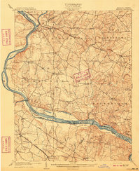
1908 · Seneca
USGS Topo · 1:62,500

1908 · Ijamsville
USGS Topo · 1:62,500

1909 · Ijamsville
USGS Topo · 1:62,500

1910 · Antietam
USGS Topo · 1:62,500