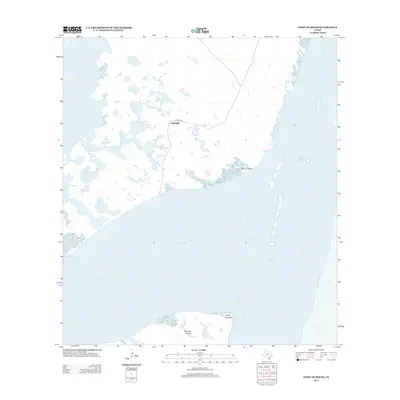
2013 Map of Point of Rocks
USGS Topo · Published 2013About this map
Baffin Bay and Laguna Madre dominate this coastal survey of Kleberg County, where shallow saltwater flats and intricate shorelines define the South Texas landscape. The prominent Point of Rocks extends into the bay, serving as a significant landmark for maritime navigation and local geography. Further south, the map details the shoreline features of Point Penascal and Penascal Rincon, areas shaped by the dynamic wind and tide patterns of the Gulf Coast. Inland, the presence of El Martillo and the waterway of Compuerta suggest the agricultural and ranching foundations of the region. This 2013 snapshot provides a clear view of the hydrological connectivity between Alazan Bay and the larger bay systems before the coastal environment's ongoing shifts.
Find a feature on this map
8 named features on this map. Tap any name to fly to it.
Don’t see what you’re looking for? This feature index may not catch every label — zoom into the map to look around manually.
Map Details
Editions of this 2013 Point of Rocks Map
This is the sole edition of this map. No revisions or reprints were ever made.
Other maps of this area

1928 · Sarita
USGS Topo · 1:125,000

1950 · Corpus Christi
USGS Topo · 1:250,000

1951 · South Bird Island
USGS Topo · 1:24,000

1951 · South Bird Island SE
USGS Topo · 1:24,000

1951 · South Bird Island NW
USGS Topo · 1:24,000

1951 · Point Of Rocks
USGS Topo · 1:24,000

1951 · Kleberg Point
USGS Topo · 1:24,000

1951 · Riviera Beach NE
USGS Topo · 1:24,000

1951 · Sarita 4 NE
USGS Topo · 1:24,000

1951 · South Bird Island
USGS Topo · 1:62,500