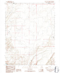
1986 Map of Point of Rocks West
USGS Topo · Published 1987About this map
Point of Rocks stands as a prominent topographical landmark in this high desert landscape, situated near the boundary where Emery Co meets Wayne Co. The terrain is defined by a network of drainage systems and deep cuts, including Buck Canyon and Pasture Canyon in the southern reaches. These features reflect the complex erosion patterns of the Colorado Plateau, where seasonal water flow through Blackburn Draw and Little Antelope Valley shapes the arid environment. A portion of the Dirty Devil river system appears at the bottom edge, providing a crucial water reference in a region characterized by its lack of permanent settlements. This 1980s field-checked survey documents the area's primitive transportation network, consisting primarily of unimproved 4WD tracks that navigate the ridges and canyon floors between these geologic formations.
Find a feature on this map
7 named features on this map. Tap any name to fly to it.
Don’t see what you’re looking for? This feature index may not catch every label — zoom into the map to look around manually.
Map Details
Editions of this 1986 Point of Rocks West Map
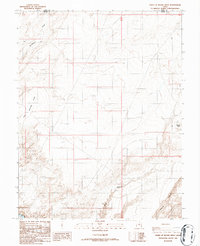
2 editions found
Other maps of this area

1885 · San Rafael
USGS Topo · 1:250,000

1953 · Temple Mtn
USGS Topo · 1:62,500

1954 · Stinking Springs Creek 4 SW
USGS Topo · 1:24,000

1954 · Stinking Spring Creek 4 SE
USGS Topo · 1:24,000

1954 · Mt. Ellen 1 NW
USGS Topo · 1:24,000

1954 · Mt. Ellen 1 SW
USGS Topo · 1:24,000

1956 · Salina
USGS Topo · 1:250,000

1960 · Salina
USGS Topo · 1:250,000

1962 · Salina
USGS Topo · 1:250,000

1963 · Robbers Roost Canyon
USGS Topo · 1:62,500