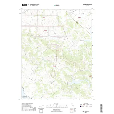
2018 Map of Point Reyes NE
USGS Topo · Published 2018About this map
Chileno Valley forms a significant low-lying corridor through the coastal hills of the Northern California dairy country, where the Sonoma and Marin County line bisects the landscape. The terrain is defined by a series of northwest-trending ridges and narrow canyons, including Bolinas Ridge and Frink Canyon, that drain toward the coast. Significant water features like the Soulajule Reservoir and the headwaters of Walker Cr illustrate the drainage patterns of the coastal range, while the southwestern corner of the sheet touches the protected lands of the Golden Gate National Recreation Area near Tomales Bay. The road network, including the Marshall Petaluma Rd and Chileno Valley Rd, follows the natural contours of the valleys, reflecting the historical connection between rural ranching lands and the regional markets of Petaluma.
Find a feature on this map
32 named features on this map. Tap any name to fly to it.
Don’t see what you’re looking for? This feature index may not catch every label — zoom into the map to look around manually.
Map Details
Editions of this 2018 Point Reyes NE Map
This is the sole edition of this map. No revisions or reprints were ever made.
Other maps of this area

1914 · Petaluma
USGS Topo · 1:62,500

1916 · Santa Rosa
USGS Topo · 1:62,500

1916 · Point Reyes
USGS Topo · 1:48,000

1918 · Point Reyes
USGS Topo · 1:62,500

1935 · Sebastopol
USGS Topo · 1:48,000

1942 · Sebastopol
USGS Topo · 1:62,500

1942 · Petaluma
USGS Topo · 1:62,500

1944 · Santa Rosa
USGS Topo · 1:62,500

1947 · Santa Rosa
USGS Topo · 1:250,000

1949 · Santa Rosa
USGS Topo · 1:250,000