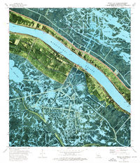
1973 Map of Pointe a La Hache
USGS Topo · Published 1976About this map
The Mississippi River defines the corridor of life and industry in this portion of Plaquemines Parish, where narrow strips of cultivated land cling to the riverbanks before giving way to an expansive network of marsh and open water. Along the east bank, Pointe a la Hache serves as a focal point for the community, supported by the Pointe a la Hache Boat Harbor and spiritual landmarks like Hope Chapel. Across the water, the New Orleans and Coast RR tracks follow the western levee, connecting settlements such as Point Celeste and Magnolia.
Find a feature on this map
42 named features on this map. Tap any name to fly to it.
Don’t see what you’re looking for? This feature index may not catch every label — zoom into the map to look around manually.
Map Details
Editions of this 1973 Pointe a La Hache Map
2 editions found
Other maps of this area

1891 · Pointe a La Hache
USGS Topo · 1:62,500

1892 · Quarantine
USGS Topo · 1:62,500

1892 · Pointe a La Hache
USGS Topo · 1:62,500

1893 · Fort Livingston
USGS Topo · 1:62,500

1893 · Dime
USGS Topo · 1:62,500

1935 · Port Sulphur
USGS Topo · 1:31,680

1935 · Lake Batola
USGS Topo · 1:31,680

1935 · Wilkinson Bay
USGS Topo · 1:31,680

1939 · Pointe a La Hache
USGS Topo · 1:62,500

1941 · Black Bay
USGS Topo · 1:62,500