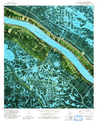
1973 Map of Pointe a La Hache
USGS Topo · Published 1992About this map
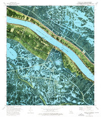
The Mississippi River dominates this orthophotomap, its broad course flanked by narrow strips of cultivated land and riverfront settlements in Plaquemines Parish. On the east bank, the parish seat of Pointe a la Hache serves as a focal point for the region’s river-and-marsh economy, featuring the Pointe a la Hache Boat Harbor and a vital Ferry connection to the west bank. The landscape transitions abruptly from the structured geometry of riverside fields near Woodland and Magnolia into the intricate, water-logged expanses of the Pointe a la Hache Oil and Gas Field. Beyond the levees, the map reveals a complex network of bays including Wreck Bay and First Bay, alongside significant water bodies like Lake Judge Perez. Local heritage is anchored by landmarks such as the St Thomas Cem and St Thomas Chapel, which mark the long-standing communities along this dynamic reach of the river.
Find a feature on this map
43 named features on this map. Tap any name to fly to it.
Don’t see what you’re looking for? This feature index may not catch every label — zoom into the map to look around manually.
Map Details
Editions of this 1973 Pointe a La Hache Map
2 editions found
Other maps of this area

1891 · Pointe a La Hache
USGS Topo · 1:62,500

1892 · Quarantine
USGS Topo · 1:62,500

1892 · Pointe a La Hache
USGS Topo · 1:62,500

1893 · Fort Livingston
USGS Topo · 1:62,500

1893 · Dime
USGS Topo · 1:62,500

1935 · Port Sulphur
USGS Topo · 1:31,680

1935 · Lake Batola
USGS Topo · 1:31,680

1935 · Wilkinson Bay
USGS Topo · 1:31,680

1939 · Pointe a La Hache
USGS Topo · 1:62,500

1941 · Black Bay
USGS Topo · 1:62,500