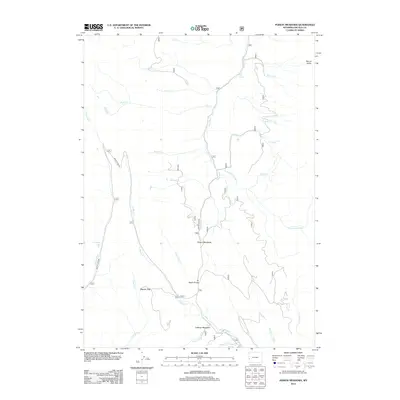
2012 Map of Poison Meadows
USGS Topo · Published 2012About this map
Tri Basin Divide serves as the hydrological centerpiece of this high-altitude Wyoming landscape, where the headwaters of several major drainages diverge. The terrain is defined by the winding course of the Greys River and its numerous tributaries, including the E Fork Greys River and Mink Cr. To the west, the Smiths Fork valley is accessible via Smiths Fork Rd, passing near Crystal Lake as it heads toward the higher elevations of Wagner Pass. This area is characterized by vast meadows used for grazing and transit, most notably Poison Meadows and LaBarge Meadows in the south. The complex network of watercourses, such as La Barge Cr and Shale Cr, illustrates the importance of this watershed for regional water management and historical livestock movement in the Bridger-Teton area.
Find a feature on this map
27 named features on this map. Tap any name to fly to it.
Don’t see what you’re looking for? This feature index may not catch every label — zoom into the map to look around manually.
Map Details
Editions of this 2012 Poison Meadows Map
This is the sole edition of this map. No revisions or reprints were ever made.
Other maps of this area

1921 · Afton
USGS Topo · 1:125,000

1936 · Cokeville
USGS Topo · 1:96,000

1942 · Cokeville
USGS Topo · 1:125,000

1955 · Preston
USGS Topo · 1:250,000

1958 · Preston
USGS Topo · 1:250,000

1962 · Preston
USGS Topo · 1:250,000

1967 · Graham Peak
USGS Topo · 1:24,000

1967 · Porcupine Creek
USGS Topo · 1:24,000

1967 · Mount Thompson
USGS Topo · 1:24,000
1980 · Mount Schidler
USGS Topo · 1:24,000