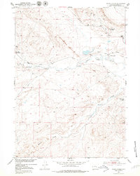
1951 Map of Poison Spider
USGS Topo · Published 1979About this map
The Poison Spider Oil Field anchors this mid-century survey of the Wyoming landscape northwest of Casper. In the early 1950s, the area’s economy was defined by a mix of ranching and extraction, evidenced by the West Poison Spider Camp and the presence of an Oil Well and Oil Tank. While the energy sector grew, the map also notes the Poison Spider Coal Mine (Inactive), marking a shift in local mining activity.
Find a feature on this map
15 named features on this map. Tap any name to fly to it.
Don’t see what you’re looking for? This feature index may not catch every label — zoom into the map to look around manually.
Map Details
Editions of this 1951 Poison Spider Map
4 editions found
Other maps of this area

1951 · Pine Mountain SW
USGS Topo · 1:24,000

1951 · Oil Mountain
USGS Topo · 1:24,000

1951 · Clarkson Hill
USGS Topo · 1:24,000

1951 · Emigrant Gap NW
USGS Topo · 1:24,000

1951 · Poison Spider
USGS Topo · 1:24,000

1951 · Benton Basin NE
USGS Topo · 1:24,000

1951 · Mc Cleary Reservoir
USGS Topo · 1:24,000

1951 · Square Top Butte
USGS Topo · 1:24,000

1951 · Reid Canyon
USGS Topo · 1:24,000

1955 · Casper
USGS Topo · 1:250,000