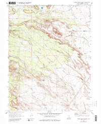
1969 Map of Poison Spring Bench
USGS Topo · Published 1983About this map
The Poison Spring Bench dominates the center of this high-desert landscape on the boundary between Carbon and Emery counties. In the late 1960s, the terrain was defined by a complex network of ephemeral drainage systems including Jackass Wash, Sand Wash, and Timothy Wash. Evidence of earlier industrial activity is preserved through the Old Railroad Grade and a Tailings Pond near the western edge. This area, largely defined by its water sources, features several critical desert watering points such as Clawson Spring, Goat Ranch Spring, and Cottonwood Spring. The topographic detail also highlights localized landmarks like The Knoll and the broad, level expanse of Trimble Flat, providing a clear picture of the land's utility for ranching and resource extraction during this era.
Find a feature on this map
27 named features on this map. Tap any name to fly to it.
Don’t see what you’re looking for? This feature index may not catch every label — zoom into the map to look around manually.
Map Details
Editions of this 1969 Poison Spring Bench Map
3 editions found
Other maps of this area

1885 · Manti
USGS Topo · 1:250,000

1886 · Price River
USGS Topo · 1:250,000

1895 · Manti
USGS Topo · 1:250,000

1896 · Price River
USGS Topo · 1:250,000

1914 · Castle Gate
USGS Topo · 1:62,500

1916 · Castle Gate
USGS Topo · 1:62,500

1923 · Scofield
USGS Topo · 1:62,500

1923 · Hiawatha
USGS Topo · 1:62,500

1925 · Scofield
USGS Topo · 1:62,500

1925 · Hiawatha
USGS Topo · 1:62,500