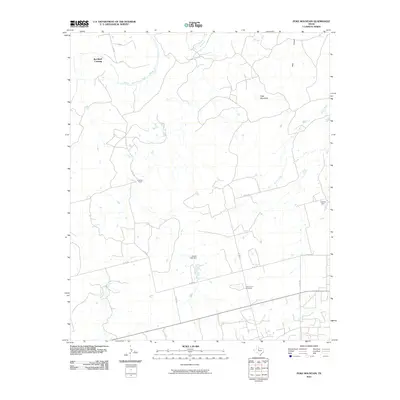
2010 Map of Poke Mountain
USGS Topo · Published 2010About this map
The Double Mountain Fork Brazos River winds through this rural portion of Stonewall County, creating a landscape of canyons and creek beds. Near the river's bend lies Red Bluff Crossing, a location defined by the intersecting hydrology of the region. The map highlights the sparse ranching infrastructure typical of West Texas, including the Crescent Ranch and several man-made water features such as Cooper Lake Dam and Holland Dam.
Find a feature on this map
18 named features on this map. Tap any name to fly to it.
Don’t see what you’re looking for? This feature index may not catch every label — zoom into the map to look around manually.
Map Details
Editions of this 2010 Poke Mountain Map
This is the sole edition of this map. No revisions or reprints were ever made.
Other maps of this area

1893 · Roby
USGS Topo · 1:125,000

1926 · Roby 2-b
USGS Topo · 1:48,000

1931 · Rotan
USGS Topo · 1:62,500

1931 · Aspermont
USGS Topo · 1:62,500

1954 · Lubbock
USGS Topo · 1:250,000

1954 · Big Spring
USGS Topo · 1:250,000

1958 · Big Spring
USGS Topo · 1:250,000
1965 · Hamlin NW
USGS Topo · 1:24,000

1965 · McCaulley
USGS Topo · 1:24,000

1968 · Double Mountains
USGS Topo · 1:24,000