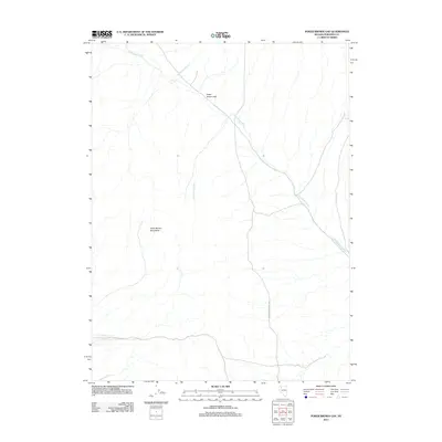
2011 Map of Poker Brown Gap
USGS Topo · Published 2011About this map
Poker Brown Mountains dominate the western portion of this high desert landscape in Pershing County, where the terrain is defined by dry washes and drainage patterns common to the Great Basin. The topography is anchored by Poker Brown Gap, a significant natural pass that facilitates movement through the mountain range. This arid environment is further characterized by the ephemeral Poker Brown Wash and the northern reach of Rabbithole Creek, which illustrate the seasonal hydrology of the region. Human presence in this isolated section of Nevada is represented by the remote Poker Brown Camp Rd, which provides access to the interior of the quadrangle. The lack of established settlements highlights the preservation of the open range and the persistent character of the Nevada backcountry into the early 21st century.
Find a feature on this map
5 named features on this map. Tap any name to fly to it.
Don’t see what you’re looking for? This feature index may not catch every label — zoom into the map to look around manually.
Map Details
Editions of this 2011 Poker Brown Gap Map
This is the sole edition of this map. No revisions or reprints were ever made.
Other maps of this area

1931 · Lovelock
USGS Topo · 1:250,000

1935 · Lovelock
USGS Topo · 1:250,000

1955 · Lovelock
USGS Topo · 1:250,000

1956 · Oreana
USGS Topo · 1:62,500

1959 · Lovelock
USGS Topo · 1:250,000

1971 · Majuba Mtn
USGS Topo · 1:24,000

1971 · Poker Brown
USGS Topo · 1:24,000

1981 · Scossa
USGS Topo · 1:24,000

1981 · Placerites
USGS Topo · 1:24,000

1981 · Natchez Spring
USGS Topo · 1:24,000