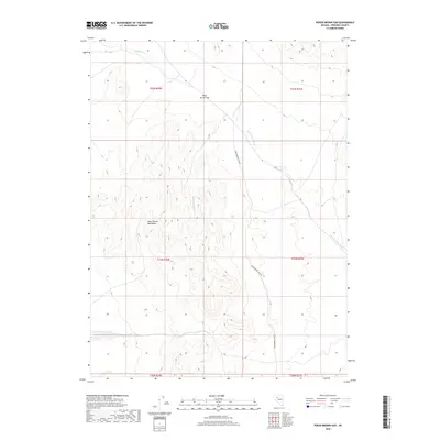
2018 Map of Poker Brown Gap
USGS Topo · Published 2018About this map
The Poker Brown Mountains dominate this high-desert landscape in Pershing County, where the topography is defined by significant elevation changes and seasonal drainage patterns. Central to the area is Poker Brown Gap, a distinctive pass that serves as a natural transition point through the range. Access to the interior is primarily through Poker Brown Camp Rd, which parallels the drainage of Poker Brown Wash as it descends toward the southeast. In the northern reaches, the seasonal flow of Rabbithole Cr cuts across the basin, indicating the specialized hydrological network of this arid region. The map highlights the Public Land Survey System divisions, including t31n r30e and t32n r30e, which are essential for tracing land ownership and grazing rights in this part of Nevada.
Find a feature on this map
11 named features on this map. Tap any name to fly to it.
Don’t see what you’re looking for? This feature index may not catch every label — zoom into the map to look around manually.
Map Details
Editions of this 2018 Poker Brown Gap Map
This is the sole edition of this map. No revisions or reprints were ever made.
Other maps of this area

1931 · Lovelock
USGS Topo · 1:250,000

1935 · Lovelock
USGS Topo · 1:250,000

1955 · Lovelock
USGS Topo · 1:250,000

1956 · Oreana
USGS Topo · 1:62,500

1959 · Lovelock
USGS Topo · 1:250,000

1971 · Majuba Mtn
USGS Topo · 1:24,000

1971 · Poker Brown
USGS Topo · 1:24,000

1981 · Scossa
USGS Topo · 1:24,000

1981 · Placerites
USGS Topo · 1:24,000

1981 · Natchez Spring
USGS Topo · 1:24,000