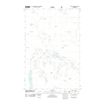
2011 Map of Polallie Ridge
USGS Topo · Published 2011About this map
Polallie Ridge Lookout stands as a central sentinel over this high-country landscape in the central Cascades, where glacial lakes and narrow river valleys define the terrain. The hydrological network is particularly dense here, anchored by the Cooper River and the Waptus River, which drain numerous high-elevation basins such as Escondido Lake and Pete Lake. The map details a complex system of mountain transit, showing how Waptus Pass and Copper Pass provide natural corridors through the peaks. To the south, the waters of Little Kachess Lake and the Kachess River reflect the importance of these alpine reservoirs. Notable peaks like Island Mountain, Cone Mountain, and Red Mountain create a formidable geography, while smaller features like Diamond Lake and Tumble Creek indicate the detailed surveying of this wilderness area.
Find a feature on this map
30 named features on this map. Tap any name to fly to it.
Don’t see what you’re looking for? This feature index may not catch every label — zoom into the map to look around manually.
Map Details
Editions of this 2011 Polallie Ridge Map
This is the sole edition of this map. No revisions or reprints were ever made.
Other maps of this area

1901 · Snoqualmie Pass
USGS Topo · 1:125,000

1902 · Skykomish
USGS Topo · 1:125,000

1903 · Snoqualmie
USGS Topo · 1:125,000

1905 · Skykomish
USGS Topo · 1:125,000

1957 · Wenatchee
USGS Topo · 1:250,000

1961 · Snoqualmie Pass
USGS Topo · 1:62,500

1961 · Kachess Lake
USGS Topo · 1:62,500

1965 · Mount Daniel
USGS Topo · 1:24,000
1965 · Big Snow Mtn
USGS Topo · 1:24,000
1965 · The Cradle
USGS Topo · 1:24,000