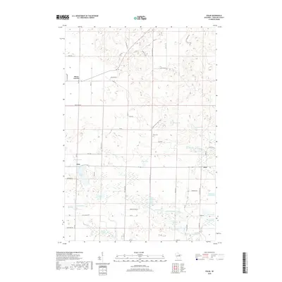
2018 Map of Polar
USGS Topo · Published 2018About this map
Glacial topography and a complex network of freshwater springs define this northern Wisconsin landscape. The small community of Polar and the rail-associated Sherry Junction serve as local hubs, while the Ice Age National Scenic Trail traverses the northern and central reaches, tracing the post-glacial terrain. This 2018 survey reveals a territory dense with named water features, including Norway Lake, Dodge Lake, and Joyce Lake.
Find a feature on this map
66 named features on this map. Tap any name to fly to it.
Don’t see what you’re looking for? This feature index may not catch every label — zoom into the map to look around manually.
Map Details
Editions of this 2018 Polar Map
This is the sole edition of this map. No revisions or reprints were ever made.
Other maps of this area

1942 · Elcho
USGS Topo · 1:48,000

1942 · Pearson
USGS Topo · 1:48,000

1950 · Elcho
USGS Topo · 1:48,000

1950 · Lily
USGS Topo · 1:48,000

1952 · Antigo
USGS Topo · 1:48,000

1952 · White Lake
USGS Topo · 1:48,000

1954 · Iron Mountain
USGS Topo · 1:250,000

1959 · Iron Mountain
USGS Topo · 1:250,000
1973 · Bryant
USGS Topo · 1:24,000
1973 · Mattoon
USGS Topo · 1:24,000