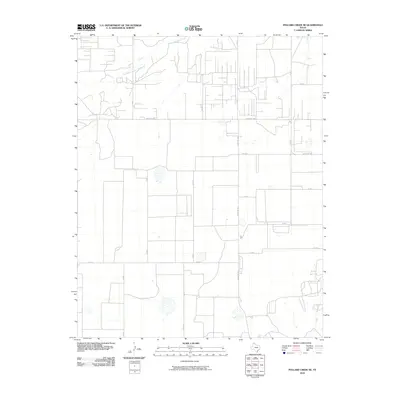
2010 Map of Pollard Creek NE
USGS Topo · Published 2010About this map
South Palo Duro Creek meanders through this section of the Texas Panhandle, defining a drainage landscape that contrasts with the surrounding agricultural and ranching grid. This 2010 survey of Moore County showcases the precise section-line road network typical of the High Plains, where routes like Co Rd 2 and Co Rd 4 carve out large-scale land divisions. The intersection of local county roads with state-maintained routes such as Ranch Rd 1598 and Ranch Rd 1923 highlights the transportation infrastructure necessary for the region's energy and agricultural production. To the southeast, the terrain descends toward Big Creek, offering a glimpse into the natural topography before it meets the starkly geometric boundaries of the nearby rural parcels.
Find a feature on this map
14 named features on this map. Tap any name to fly to it.
Don’t see what you’re looking for? This feature index may not catch every label — zoom into the map to look around manually.
Map Details
Editions of this 2010 Pollard Creek NE Map
This is the sole edition of this map. No revisions or reprints were ever made.
Other maps of this area

1953 · Stinnett
USGS Topo · 1:24,000

1953 · Pringle
USGS Topo · 1:24,000

1954 · Perryton
USGS Topo · 1:250,000

1954 · Amarillo
USGS Topo · 1:250,000

1958 · Perryton
USGS Topo · 1:250,000

1958 · Amarillo
USGS Topo · 1:250,000
1972 · Pollard Creek
USGS Topo · 1:24,000

1972 · Capps Switch
USGS Topo · 1:24,000
1972 · Pollard Creek NW
USGS Topo · 1:24,000

1974 · Morse
USGS Topo · 1:24,000